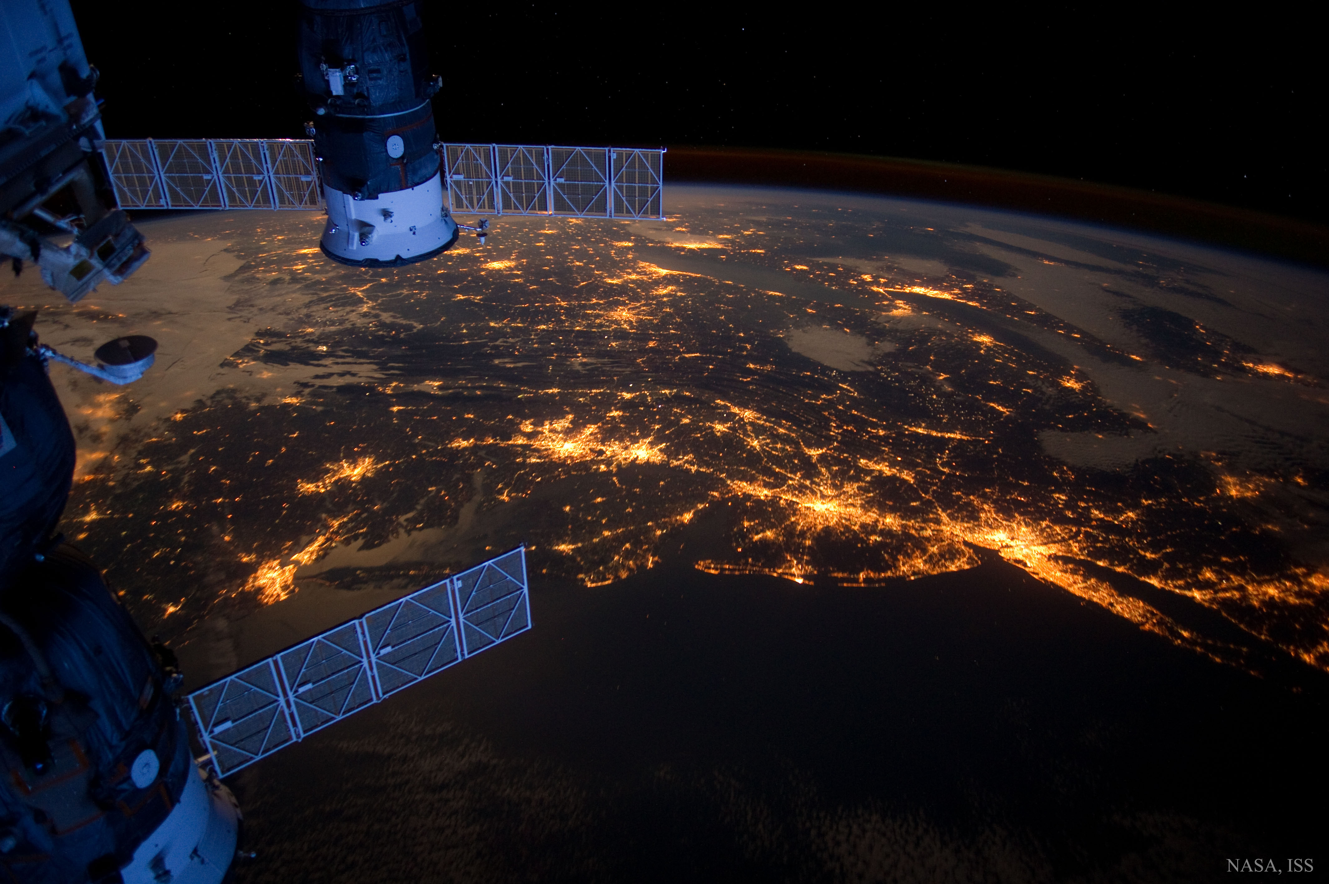
This is a shot of part of the United States' east coast, taken from the International Space Station. Recently featured on Astronomy Picture of the Day, it captures six major cities: Norfolk on the far left, followed by Richmond, Washington, D.C., Baltimore, Philadelphia, and finally New York City on the far right. Also included in this shot (but somehow inexplicably not worth mentioning in the photo's APOD description) is my hometown of some 6,000 people, located somewhere more or less between the bright patches of D.C. and Baltimore.
While the photos that are taken of objects in space are really amazing (see: pretty much every other photo on APOD), it's also pretty cool what we can see just by pointing a camera at our own planet--especially when that camera is pointed from hundreds of miles above Earth. Satellite images aren't just pretty pictures, either--they can actually be useful. Google uses satellite imagery to power Google Maps, for example, and satellite images are really important for weather reporting.
...but not they're not the most important things for weather reporting.
|
On top of that, satellite photos can reveal a whole new perspective of our planet, and can open our eyes to things we hadn't considered before. Before I saw a satellite image of the Northern lights, I thought that they were just an optical illusion of some sort that were dependent on a terrestrial vantage point. After seeing pictures like the one below, I realized that the lights aren't an illusion, and I became interested in learning more about what they were.
Finally, satellite images can inspire. There's not much cooler than a picture of an astronaut with the Earth (and on it almost every other person in existence) looming in the background. Doesn't it make you feel like we can do anything?
 |
| This is another image taken from the ISS. |
 |
| The first untethered space walk (1984). |
Sources:
http://apod.nasa.gov/apod/image/1602/NorthEastUSA_ISS_4256.jpg
https://en.wikipedia.org/wiki/International_Space_Station
https://en.wikipedia.org/wiki/Google_Earth
https://en.wikipedia.org/wiki/Satellite_imagery
http://giphy.com/gifs/cat-lol-news-Vr6ZgLp3kYWT6
https://i.ytimg.com/vi/ogtKe7N05F0/maxresdefault.jpg
https://i.ytimg.com/vi/ogtKe7N05F0/maxresdefault.jpg
http://www.airspacemag.com/photos/top-nasa-photos-of-all-time-9777715/

Great post
ReplyDelete